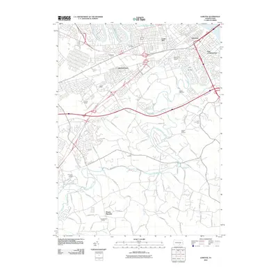
2010 Map of Lemoyne
USGS Topo · Published 2010About this map
Yellow Breeches Creek meanders across this landscape, serving as a defining geographical feature south of the densely developed boroughs. The map illustrates a transitional suburban environment where established communities like Shiremanstown, Camp Hill, and Lemoyne meet newer residential clusters such as Bethany Village and Messiah Village. This area shows a complex network of transportation and land use, with the Susquehanna River clipping the northeastern corner near New Cumberland.
Find a feature on this map
89 named features on this map. Tap any name to fly to it.
Don’t see what you’re looking for? This feature index may not catch every label — zoom into the map to look around manually.
Map Details
Editions of this 2010 Lemoyne Map
This is the sole edition of this map. No revisions or reprints were ever made.
Other maps of this area

1892 · Harrisburg
USGS Topo · 1:62,500

1899 · Harrisburg
USGS Topo · 1:62,500

1904 · Carlisle
USGS Topo · 1:62,500

1906 · New Cumberland
USGS Topo · 1:62,500

1907 · New Bloomfield
USGS Topo · 1:62,500

1924 · Harrisburg
USGS Topo · 1:62,500

1943 · New Cumberland
USGS Topo · 1:62,500

1943 · Harrisburg
USGS Topo · 1:62,500

1943 · New Bloomfield
USGS Topo · 1:62,500

1943 · Carlisle
USGS Topo · 1:62,500