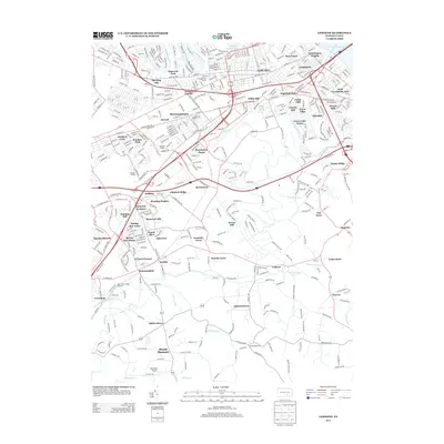
2013 Map of Lemoyne
USGS Topo · Published 2013About this map
The Yellow Breeches Cr and Conodoguinet Cr frame a landscape of dense residential development and historic crossroads communities in this 2013 survey. The northern portion is characterized by the established boroughs of Shiremanstown and Lemoyne, where a tight grid of streets like Hummel Ave and Market St meet significant transit corridors. Notable landmarks including Peace Church and the Armitage Golf Course are situated near the winding path of the creeks, illustrating the intersection of communal history and local recreation.
Find a feature on this map
85 named features on this map. Tap any name to fly to it.
Don’t see what you’re looking for? This feature index may not catch every label — zoom into the map to look around manually.
Map Details
Editions of this 2013 Lemoyne Map
This is the sole edition of this map. No revisions or reprints were ever made.
Other maps of this area

1892 · Harrisburg
USGS Topo · 1:62,500

1899 · Harrisburg
USGS Topo · 1:62,500

1904 · Carlisle
USGS Topo · 1:62,500

1906 · New Cumberland
USGS Topo · 1:62,500

1907 · New Bloomfield
USGS Topo · 1:62,500

1924 · Harrisburg
USGS Topo · 1:62,500

1943 · New Cumberland
USGS Topo · 1:62,500

1943 · Harrisburg
USGS Topo · 1:62,500

1943 · New Bloomfield
USGS Topo · 1:62,500

1943 · Carlisle
USGS Topo · 1:62,500