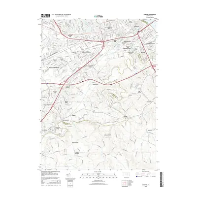
2016 Map of Lemoyne
USGS Topo · Published 2016About this map
Yellow Breeches Creek winds through this landscape, defining the winding boundary between Cumberland and York counties. The area is characterized by dense suburban development transitioning into the limestone valley's agricultural heritage, with established communities like Shiremanstown and Mechanicsburg centered along the historical transport corridors of the Carlisle Pike and Gettysburg Rd. Education and faith are central to the local geography, anchored by the campus of Messiah College near Bowmansdale and numerous community landmarks such as Saint Johns Cem. To the north, the meanders of Conodoguinet Creek frame the borough of Camp Hill, while the southeastern corner reveals smaller settlements like Lisburn and Bunches. This detailed topographic view captures the modern expansion of the Harrisburg suburbs, where contemporary residential neighborhoods like Windsor Park and Rossmoyne Manor fill the spaces between long-standing mill sites and crossroads hamlets.
Find a feature on this map
62 named features on this map. Tap any name to fly to it.
Don’t see what you’re looking for? This feature index may not catch every label — zoom into the map to look around manually.
Map Details
Editions of this 2016 Lemoyne Map
This is the sole edition of this map. No revisions or reprints were ever made.
Other maps of this area

1892 · Harrisburg
USGS Topo · 1:62,500

1899 · Harrisburg
USGS Topo · 1:62,500

1904 · Carlisle
USGS Topo · 1:62,500

1906 · New Cumberland
USGS Topo · 1:62,500

1907 · New Bloomfield
USGS Topo · 1:62,500

1924 · Harrisburg
USGS Topo · 1:62,500

1943 · New Cumberland
USGS Topo · 1:62,500

1943 · Harrisburg
USGS Topo · 1:62,500

1943 · New Bloomfield
USGS Topo · 1:62,500

1943 · Carlisle
USGS Topo · 1:62,500