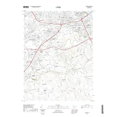
2019 Map of Lemoyne
USGS Topo · Published 2019About this map
Yellow Breeches Creek defines the local topography as it winds through a landscape of established suburban developments and historic townships south of the Susquehanna River. The map details the dense settlement patterns of Shiremanstown, Mechanicsburg, and New Cumberland, punctuated by several community institutions and memorial sites. Significant landmarks such as Fort Couch and Messiah College stand as anchors in the southern portion of the Cumberland Valley. Genealogists will find a high density of burial grounds including Saint Johns Cem, Eberly Family Cem, and Shalom Memorial Park. The intersection of major transit corridors like the Carlisle Pike and the Norfolk Southern railroad reflects the region's role as a vital transportation hub linking local hamlets like Bowmansdale and Lisburn to the broader regional economy.
Find a feature on this map
84 named features on this map. Tap any name to fly to it.
Don’t see what you’re looking for? This feature index may not catch every label — zoom into the map to look around manually.
Map Details
Editions of this 2019 Lemoyne Map
This is the sole edition of this map. No revisions or reprints were ever made.
Other maps of this area

1892 · Harrisburg
USGS Topo · 1:62,500

1899 · Harrisburg
USGS Topo · 1:62,500

1904 · Carlisle
USGS Topo · 1:62,500

1906 · New Cumberland
USGS Topo · 1:62,500

1907 · New Bloomfield
USGS Topo · 1:62,500

1924 · Harrisburg
USGS Topo · 1:62,500

1943 · New Cumberland
USGS Topo · 1:62,500

1943 · Harrisburg
USGS Topo · 1:62,500

1943 · New Bloomfield
USGS Topo · 1:62,500

1943 · Carlisle
USGS Topo · 1:62,500