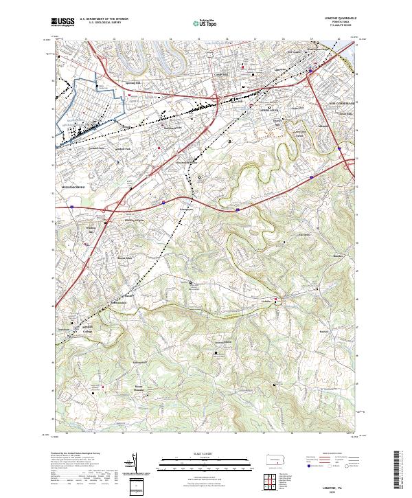
2023 Map of Lemoyne
USGS Topo · Published 2023About this map
Yellow Breeches Creek defines the transition between Cumberland and York counties, winding past established communities like Lisburn and Bowmansdale. This landscape reflects centuries of settlement along its banks, notably at Eberlys Mill and the expansive campus of Messiah College in Grantham. To the north, the urban expansion of Camp Hill, Lemoyne, and New Cumberland contrasts with the southern hills where smaller hamlets like Siddonsburg and Andersontown remain distinct. Genealogists will find a high concentration of burial grounds, including the Temple Beth Shalom Memorial Park, Slate Hill Cem, and numerous historic churchyards like Mount Zion Lutheran Church Cem. The presence of the Norfolk Southern line and major arteries like the Carlisle Pike underscores the region's enduring role as a central transportation corridor.
Find a feature on this map
82 named features on this map. Tap any name to fly to it.
Don’t see what you’re looking for? This feature index may not catch every label — zoom into the map to look around manually.
Map Details
Editions of this 2023 Lemoyne Map
This is the sole edition of this map. No revisions or reprints were ever made.
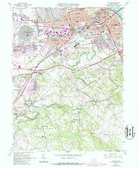
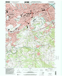
Historical Maps of Andersontown Through Time
3 maps found