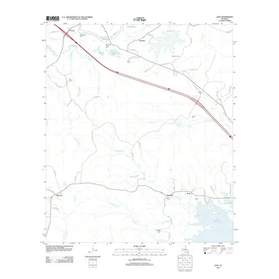
2012 Map of Lena
USGS Topo · Published 2012About this map
Lake Rodemacher dominates the southeastern corner of this central Louisiana landscape, where the bayous and creeks of Rapides Parish meet industrial and agricultural history. The transition from the high ground of McAlpine Hill and Monnett Ferry Hill down to the wetlands of Bayou Castor illustrates a typical regional drainage pattern. The map documents several established rural settlements including Flatwoods, Lena, and Galbraith, the latter of which sits adjacent to the Galbraith Oil Field.
Find a feature on this map
71 named features on this map. Tap any name to fly to it.
Don’t see what you’re looking for? This feature index may not catch every label — zoom into the map to look around manually.
Map Details
Editions of this 2012 Lena Map
This is the sole edition of this map. No revisions or reprints were ever made.
Other maps of this area

1932 · Boyce SW
USGS Topo · 1:31,680

1932 · Colfax SW
USGS Topo · 1:31,680

1936 · Colfax
USGS Topo · 1:62,500

1937 · Chopin NE
USGS Topo · 1:31,680

1937 · Chopin SW
USGS Topo · 1:31,680

1937 · Chopin NW
USGS Topo · 1:31,680

1937 · Aloha
USGS Topo · 1:31,680

1937 · Montgomery
USGS Topo · 1:62,500

1937 · Chopin SE
USGS Topo · 1:31,680

1937 · Cloutierville
USGS Topo · 1:31,680