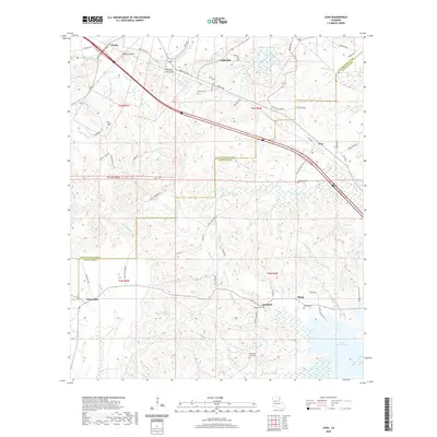
2020 Map of Lena
USGS Topo · Published 2020About this map
Lena and the surrounding piney flatwoods of northern Rapides Parish are depicted here, showing the convergence of rural road networks and water features. The settlement of Chopin sits at the northwestern corner near MCAlpine Hill, while Galbraith and Sharp anchor the eastern portions of the quadrangle. The terrain is characterized by a dense network of drainages including Bayou Castor, Carnahan Cr, and Bayou Maurice, which feed into larger bodies such as Lake Rodemacher in the southeast.
Find a feature on this map
64 named features on this map. Tap any name to fly to it.
Don’t see what you’re looking for? This feature index may not catch every label — zoom into the map to look around manually.
Map Details
Editions of this 2020 Lena Map
This is the sole edition of this map. No revisions or reprints were ever made.
Other maps of this area

1932 · Boyce SW
USGS Topo · 1:31,680

1932 · Colfax SW
USGS Topo · 1:31,680

1936 · Colfax
USGS Topo · 1:62,500

1937 · Chopin NE
USGS Topo · 1:31,680

1937 · Chopin SW
USGS Topo · 1:31,680

1937 · Chopin NW
USGS Topo · 1:31,680

1937 · Aloha
USGS Topo · 1:31,680

1937 · Montgomery
USGS Topo · 1:62,500

1937 · Chopin SE
USGS Topo · 1:31,680

1937 · Cloutierville
USGS Topo · 1:31,680