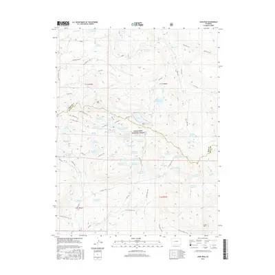
2016 Map of Leon Peak
USGS Topo · Published 2016About this map
Leon Peak dominates the high alpine landscape of the Grand Mesa National Forest, where a complex network of man-made water management features serves the surrounding high country. This survey illustrates an intricate system of storage and transport, including the Leon Tunnel and dozens of named basins such as Anderson Reservoir, Dawson Reservoir, and Island Reservoir. The terrain is defined by its transition from wooded parks like Trickle Park to the high ridges of Green Mountain and Cedar Mesa. A robust trail system, including the Leon Lake Trail and Monument Trail, connects the remote reservoirs across the Mesa and Delta County line. The infrastructure recorded here, from the Aqueduct Trail to smaller holdings like Sackett Reservoir, reveals the intensive 20th-century water development required to support the arid Colorado Western Slope.
Find a feature on this map
91 named features on this map. Tap any name to fly to it.
Don’t see what you’re looking for? This feature index may not catch every label — zoom into the map to look around manually.
Map Details
Editions of this 2016 Leon Peak Map
This is the sole edition of this map. No revisions or reprints were ever made.
Other maps of this area

1955 · Collbran
USGS Topo · 1:24,000

1955 · Grand Mesa
USGS Topo · 1:24,000

1955 · The Meadows
USGS Topo · 1:24,000

1956 · Montrose
USGS Topo · 1:250,000

1957 · Leadville
USGS Topo · 1:250,000

1959 · Leadville
USGS Topo · 1:250,000

1959 · Montrose
USGS Topo · 1:250,000

1960 · Leadville
USGS Topo · 1:250,000

1960 · Montrose
USGS Topo · 1:250,000

1960 · Leon Peak
USGS Topo · 1:24,000