2022 Map of Leona
USGS Topo · Published 2022About this map
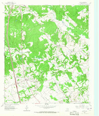
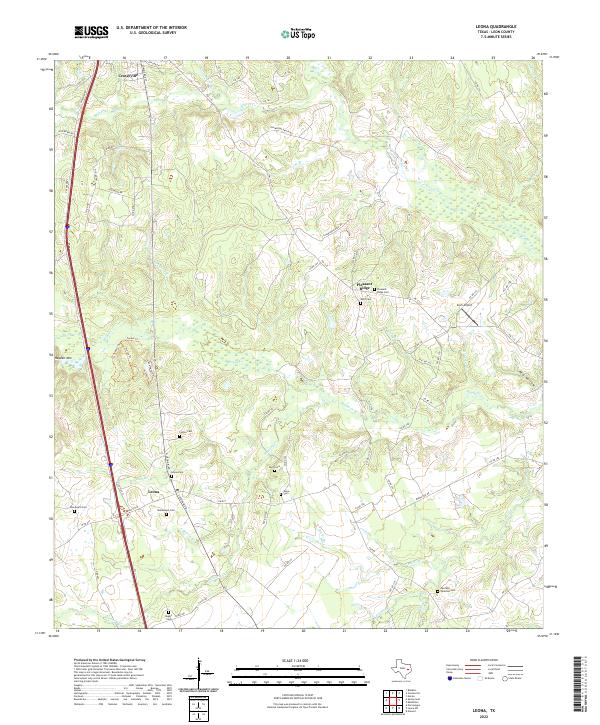
Leona and the southern outskirts of Centerville anchor this part of Leon County, characterized by a complex network of creeks and numerous family and community burial grounds. The landscape is defined by the drainage of Boggy Cr and Mustang Cr, with several small tributaries like Adkisson Br and Butler Br carving through the terrain. Genealogists will find a high density of rural cemeteries, including Leona Cem, Culton Cem, and Durst Cem, which reflect the localized settlement patterns of this East Texas region. Notable landmarks such as Hayden Mtn and Red Hollow provide topographical variety, while the local aviation history is represented by Zoch Airport near the eastern edge of the survey. The presence of recreational paths like Lake Nature Trl and Tunnel Trl indicates contemporary land use alongside established ranch roads and farm-to-market routes.
Find a feature on this map
81 named features on this map. Tap any name to fly to it.
Don’t see what you’re looking for? This feature index may not catch every label — zoom into the map to look around manually.
Map Details
Editions of this 2022 Leona Map
This is the sole edition of this map. No revisions or reprints were ever made.