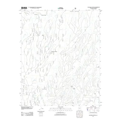
2011 Map of Leonard Canyon
USGS Topo · Published 2011About this map
Leonard Canyon and the high desert terrain of the Mogollon Rim define this landscape, where deep drainages and cattle ranching history intersect. Sparse water sources such as Limestone Spring, Chavez Spring, and Spaulding Spring provided vital support for isolated outposts like Wiggins Ranch and Hugh Barr Ranch. The area's transit patterns are marked by historic river crossings, including Macks Crossing and Victorine Crossing, which connect ridges like Cave Ridge and Cart Ridge. A complex network of Forest Service roads, such as FS RD 96, winds through the canyons and draws, reflecting the area's ongoing use for land management and ranching. The presence of numerous tanks, including Wilkins Trick Tank and Second Chance Tank, highlights the engineered efforts to manage seasonal runoff in this arid environment.
Find a feature on this map
43 named features on this map. Tap any name to fly to it.
Don’t see what you’re looking for? This feature index may not catch every label — zoom into the map to look around manually.
Map Details
Editions of this 2011 Leonard Canyon Map
This is the sole edition of this map. No revisions or reprints were ever made.
Other maps of this area

1886 · Holbrook
USGS Topo · 1:250,000

1887 · Verde
USGS Topo · 1:250,000

1892 · Verde
USGS Topo · 1:250,000

1893 · Holbrook
USGS Topo · 1:250,000

1934 · Promontory Butte
USGS Topo · 1:62,500

1939 · Promontory Butte
USGS Topo · 1:62,500

1952 · Promontory Butte
USGS Topo · 1:62,500

1954 · Holbrook
USGS Topo · 1:250,000

1957 · Holbrook
USGS Topo · 1:250,000

1958 · Holbrook
USGS Topo · 1:250,000