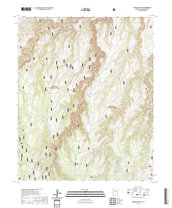
2021 Map of Leonard Canyon
USGS Topo · Published 2021About this map
Coconino National Forest and Sitgreaves National Forest meet in this high-altitude landscape atop the Mogollon Plateau. The boundary between these federal lands is defined by the deep, winding course of Leonard Canyon, which cuts through the center of the sheet. Evidence of early land use and water management is scattered across the ridges, with named features such as Spaulding Spring, Limestone Spring, and Chavez Spring alongside stock tanks like Pius Tank. Historically significant routes, including the Victorine Crossing Trl and Leonard Point Trl, suggest the movement of people and livestock through this complex drainage system. The terrain is further defined by prominent landmarks like Buck Springs Ridge and Cave Ridge, illustrating the geological character of the Arizona high country.
Find a feature on this map
35 named features on this map. Tap any name to fly to it.
Don’t see what you’re looking for? This feature index may not catch every label — zoom into the map to look around manually.
Map Details
Editions of this 2021 Leonard Canyon Map
This is the sole edition of this map. No revisions or reprints were ever made.
Other maps of this area

1886 · Holbrook
USGS Topo · 1:250,000

1887 · Verde
USGS Topo · 1:250,000

1892 · Verde
USGS Topo · 1:250,000

1893 · Holbrook
USGS Topo · 1:250,000

1934 · Promontory Butte
USGS Topo · 1:62,500

1939 · Promontory Butte
USGS Topo · 1:62,500

1952 · Promontory Butte
USGS Topo · 1:62,500

1954 · Holbrook
USGS Topo · 1:250,000

1957 · Holbrook
USGS Topo · 1:250,000

1958 · Holbrook
USGS Topo · 1:250,000