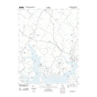
2011 Map of Leonardtown
USGS Topo · Published 2011About this map
Leonardtown serves as the regional hub in this part of Saint Mary's County, situated where McIntosh Run flows into the expansive Breton Bay. The landscape is defined by the deeply indented shoreline of the Potomac River estuary, featuring numerous points such as Foxwell Point and Pawpaw Point. Rural life and maritime history intersect at landmarks like Barton Hall and Stones Wharf, while the interior is dotted with established settlements including Loveville and Clements.
Find a feature on this map
173 named features on this map. Tap any name to fly to it.
Don’t see what you’re looking for? This feature index may not catch every label — zoom into the map to look around manually.
Map Details
Editions of this 2011 Leonardtown Map
This is the sole edition of this map. No revisions or reprints were ever made.
Other maps of this area

1892 · Leonardtown
USGS Topo · 1:62,500

1892 · Piney Point
USGS Topo · 1:62,500

1892 · Montross
USGS Topo · 1:62,500

1894 · Wicomico
USGS Topo · 1:62,500

1894 · Piney Point
USGS Topo · 1:62,500

1895 · Wicomico
USGS Topo · 1:62,500

1895 · Leonardtown
USGS Topo · 1:62,500

1895 · Nomini
USGS Topo · 1:125,000

1895 · Piney Point
USGS Topo · 1:62,500

1895 · Montross
USGS Topo · 1:62,500