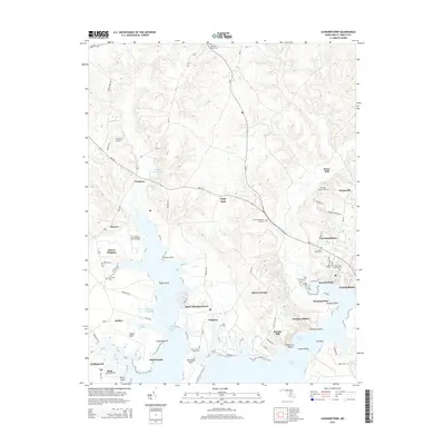
2014 Map of Leonardtown
USGS Topo · Published 2014About this map
Leonardtown serves as a focal point in this survey of Saint Mary's County, situated where the road network converges at the head of Breton Bay. The landscape is defined by the deep indentations of the Potomac River estuary, including Saint Clements Bay and the numerous named necks and points that characterize the local geography. Significant ecclesiastical and genealogical landmarks are prominent, from the waterfront Saint Francis Xavier Cem at Newtown Neck to the cluster of Saint Pauls Cem and New Saint Aloysius Cem in the county seat. The rural character of the interior is preserved through small settlements like Clements and Compton, while specialized infrastructure is visible at the Clements Airport and Recompense Farm Airport. This detailed layout reflects a traditional coastal Maryland settlement pattern where community life remains tied to both tidal inlets and historical road corridors.
Find a feature on this map
70 named features on this map. Tap any name to fly to it.
Don’t see what you’re looking for? This feature index may not catch every label — zoom into the map to look around manually.
Map Details
Editions of this 2014 Leonardtown Map
This is the sole edition of this map. No revisions or reprints were ever made.
Other maps of this area

1892 · Leonardtown
USGS Topo · 1:62,500

1892 · Piney Point
USGS Topo · 1:62,500

1892 · Montross
USGS Topo · 1:62,500

1894 · Wicomico
USGS Topo · 1:62,500

1894 · Piney Point
USGS Topo · 1:62,500

1895 · Wicomico
USGS Topo · 1:62,500

1895 · Leonardtown
USGS Topo · 1:62,500

1895 · Nomini
USGS Topo · 1:125,000

1895 · Piney Point
USGS Topo · 1:62,500

1895 · Montross
USGS Topo · 1:62,500