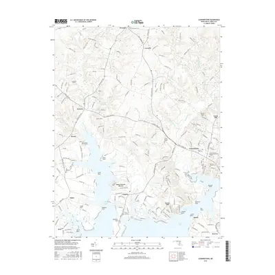
2016 Map of Leonardtown
USGS Topo · Published 2016About this map
Leonardtown serves as the regional hub of Saint Mary's County on this modern survey, characterized by a complex network of tidal estuaries and agricultural landscapes. The town's historical roots are visible through a significant concentration of cemeteries, including Old Saint Aloysius Cem and New Saint Aloysius Cem, as well as the Coll of Southern Maryland Leonardtown Campus. The landscape is defined by the jagged shoreline of Breton Bay and Saint Celments Bay, where numerous points like Newtown Neck and Pawpaw Point extend into the water. Inland, small settlements such as Morganza, Loveville, and Clements are connected by rural routes like Budds Creek Rd. The presence of small aviation facilities like Clements Airport and Recompense Farm Airport suggests the continued importance of private transport and farming in this coastal Maryland region.
Find a feature on this map
185 named features on this map. Tap any name to fly to it.
Don’t see what you’re looking for? This feature index may not catch every label — zoom into the map to look around manually.
Map Details
Editions of this 2016 Leonardtown Map
This is the sole edition of this map. No revisions or reprints were ever made.
Other maps of this area

1892 · Leonardtown
USGS Topo · 1:62,500

1892 · Piney Point
USGS Topo · 1:62,500

1892 · Montross
USGS Topo · 1:62,500

1894 · Wicomico
USGS Topo · 1:62,500

1894 · Piney Point
USGS Topo · 1:62,500

1895 · Wicomico
USGS Topo · 1:62,500

1895 · Leonardtown
USGS Topo · 1:62,500

1895 · Nomini
USGS Topo · 1:125,000

1895 · Piney Point
USGS Topo · 1:62,500

1895 · Montross
USGS Topo · 1:62,500