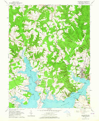
1963 Map of Leonardtown
USGS Topo · Published 1964About this map
Leonardtown serves as the focal point of this coastal Maryland landscape, situated where the estuaries of St Clement Bay and Breton Bay meet. The settlement pattern in the early 1960s reflects a deeply rooted Catholic educational and religious heritage, evidenced by the concentration of institutions such as St Marys Academy, St Josephs Sch, and Father White Sch. Along the indented shoreline, small communities like St Clement Shores and Society Hill overlook the water, while the interior is defined by agricultural lands and timbered runs. Local commerce and infrastructure are visible through the numerous Sand and Gravel Pits and the presence of the Radio Tower (WKIK). Historical continuity is marked by St Francis Xavier Ch on Newtown Neck, one of the region's oldest parish sites, and the active waterfront at Abells Wharf, illustrating the enduring relationship between the residents of St. Marys County and their aquatic environment.
Find a feature on this map
80 named features on this map. Tap any name to fly to it.
Don’t see what you’re looking for? This feature index may not catch every label — zoom into the map to look around manually.
Map Details
Editions of this 1963 Leonardtown Map
3 editions found
Other maps of this area

1892 · Leonardtown
USGS Topo · 1:62,500

1892 · Piney Point
USGS Topo · 1:62,500

1892 · Montross
USGS Topo · 1:62,500

1894 · Wicomico
USGS Topo · 1:62,500

1894 · Piney Point
USGS Topo · 1:62,500

1895 · Wicomico
USGS Topo · 1:62,500

1895 · Leonardtown
USGS Topo · 1:62,500

1895 · Nomini
USGS Topo · 1:125,000

1895 · Piney Point
USGS Topo · 1:62,500

1895 · Montross
USGS Topo · 1:62,500