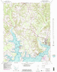
1963 Map of Leonardtown
USGS Topo · Published 1985About this map
The county seat of Leonardtown serves as the focal point of this coastal landscape, situated where McIntosh Run meets the head of Breton Bay. This 1963 survey, with bathymetric data and 1980s updates, details a Catholic heritage deeply embedded in the land, from the Father White Mem St Aloysius Ch in the village to the Old St Josephs Ch near Morganza. The map reveals the intricate shoreline of St Clements Bay, where Newtown Neck divides the water, and the historic St Francis Xavier Ch stands as a landmark of early colonial settlement.
Find a feature on this map
78 named features on this map. Tap any name to fly to it.
Don’t see what you’re looking for? This feature index may not catch every label — zoom into the map to look around manually.
Map Details
Editions of this 1963 Leonardtown Map
3 editions found
Other maps of this area

1892 · Leonardtown
USGS Topo · 1:62,500

1892 · Piney Point
USGS Topo · 1:62,500

1892 · Montross
USGS Topo · 1:62,500

1894 · Wicomico
USGS Topo · 1:62,500

1894 · Piney Point
USGS Topo · 1:62,500

1895 · Wicomico
USGS Topo · 1:62,500

1895 · Leonardtown
USGS Topo · 1:62,500

1895 · Nomini
USGS Topo · 1:125,000

1895 · Piney Point
USGS Topo · 1:62,500

1895 · Montross
USGS Topo · 1:62,500