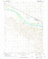
1971 Map of Lewellen
USGS Topo · Published 1974About this map
Lewellen sits at a historic crossroads in the Nebraska Panhandle, where the Union Pacific railroad and northern canal systems meet the river valley. This early 1970s survey documents the deep historical layers of the region, specifically the iconic Oregon Trail and Midland Overland routes that passed through this stretch of the North Platte River. The landscape is dominated by significant elevation shifts, from the river bottom to the heights of Signal Bluff and Clay Peak. To the southeast, the Ash Hollow Historical State Park preserves a vital pioneer landmark, including the Ash Hollow Cem and the Ash Hollow draw. Local genealogy and community infrastructure are well-represented by features like the Durham Cem, the High School, and the village Fairground, illustrating the town's role as a local hub for Garden County.
Find a feature on this map
24 named features on this map. Tap any name to fly to it.
Don’t see what you’re looking for? This feature index may not catch every label — zoom into the map to look around manually.
Map Details
Editions of this 1971 Lewellen Map
This is the sole edition of this map. No revisions or reprints were ever made.
Other maps of this area

1900 · Chappell
USGS Topo · 1:125,000

1954 · Scottsbluff
USGS Topo · 1:250,000

1958 · Scottsbluff
USGS Topo · 1:250,000
1971 · Twin Buttes
USGS Topo · 1:24,000
1971 · Big Springs NE
USGS Topo · 1:24,000
1971 · Ruthton
USGS Topo · 1:24,000

1971 · Barn Butte
USGS Topo · 1:24,000

1971 · Chappell NE
USGS Topo · 1:24,000
1971 · Old Baldy
USGS Topo · 1:24,000
1971 · Oshkosh
USGS Topo · 1:24,000