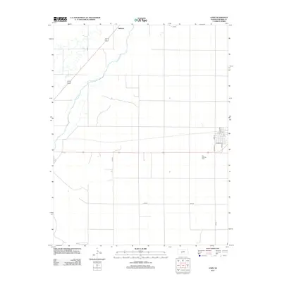
2012 Map of Lewis
USGS Topo · Published 2012About this map
The Arkansas River winds through the northwestern corner of this Kansas prairie landscape, creating a distinct hydrological corridor against the rigid township and range grid of Edwards County. Near the bend in the river, the settlement of Nettleton sits along a major transport route, while the waterway is joined by Coon Cr to the west. This 2012 survey illustrates the enduring agricultural character of the region, where a network of county roads like Co RD 27 and Co RD 26 connects dispersed farmsteads to the local hub. In the eastern portion of the sheet, the grid of Lewis is visible, featuring local thoroughfares such as Main St and Sunnyside Dr. A local Po and the Fox Landing Strip serve as focal points for the community and regional transport, reflecting the area's rural infrastructure.
Find a feature on this map
14 named features on this map. Tap any name to fly to it.
Don’t see what you’re looking for? This feature index may not catch every label — zoom into the map to look around manually.
Map Details
Editions of this 2012 Lewis Map
This is the sole edition of this map. No revisions or reprints were ever made.
Other maps of this area

1889 · Larned
USGS Topo · 1:125,000

1889 · Kinsley
USGS Topo · 1:125,000

1891 · Larned
USGS Topo · 1:125,000

1892 · Kinsley
USGS Topo · 1:125,000

1894 · Kinsley
USGS Topo · 1:125,000

1955 · Great Bend
USGS Topo · 1:250,000

1955 · Pratt
USGS Topo · 1:250,000

1957 · Great Bend
USGS Topo · 1:250,000

1958 · Great Bend
USGS Topo · 1:250,000

1959 · Pratt
USGS Topo · 1:250,000