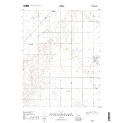
2018 Map of Lewis
USGS Topo · Published 2018About this map
The Arkansas River meanders through the northwest corner of this Edwards County landscape, defining a corridor of variable terrain alongside Coon Cr. The town of Lewis serves as the primary municipal hub in the east, where a formal grid of streets including Gerald Olsen Blvd, Jackson Ave, and Monroe Ave meets the surrounding agricultural section lines. This 2018 survey illustrates the persistent importance of the township and range system, with the intersections of 150th Ave and 180th Rd forming a rigid network across the plains. Farther north, the small settlement of Nettleton sits near the river's path, marking a secondary point of interest for local history. The map's detailed street labels within Lewis, such as Sunnyside and Gorham, provide a precise look at the modern layout of this rural Kansas community.
Find a feature on this map
38 named features on this map. Tap any name to fly to it.
Don’t see what you’re looking for? This feature index may not catch every label — zoom into the map to look around manually.
Map Details
Editions of this 2018 Lewis Map
This is the sole edition of this map. No revisions or reprints were ever made.
Other maps of this area

1889 · Larned
USGS Topo · 1:125,000

1889 · Kinsley
USGS Topo · 1:125,000

1891 · Larned
USGS Topo · 1:125,000

1892 · Kinsley
USGS Topo · 1:125,000

1894 · Kinsley
USGS Topo · 1:125,000

1955 · Great Bend
USGS Topo · 1:250,000

1955 · Pratt
USGS Topo · 1:250,000

1957 · Great Bend
USGS Topo · 1:250,000

1958 · Great Bend
USGS Topo · 1:250,000

1959 · Pratt
USGS Topo · 1:250,000