2022 Map of Lewis
USGS Topo · Published 2022About this map
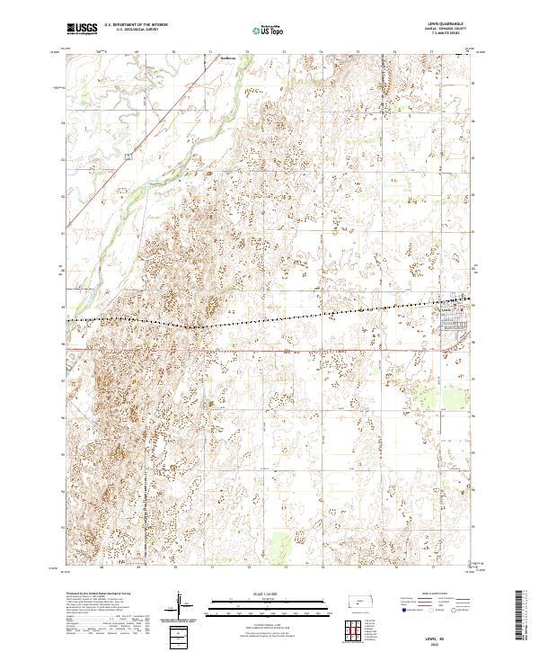
The town of Lewis serves as the primary hub on this central Kansas landscape, situated near the eastern edge of the quadrangle. A detailed street grid defines the settlement, featuring Gerald Olsen Blvd, Jackson Ave, and Monroe Ave, along with a local Po. To the northwest lies the smaller locality of Nettleton, positioned near the upper boundary. The terrain is shaped by the wide path of the Arkansas River, which flows across the northern section, joined by the winding course of Coon Cr. The surrounding area is dominated by a precise section-line road network, including routes like Sunnyside and 180th Ave, reflecting the systematic agricultural development characteristic of Edwards County. This survey reveals the proximity of the river system to these established rural communities and the established transit corridors that link them.
Find a feature on this map
36 named features on this map. Tap any name to fly to it.
Don’t see what you’re looking for? This feature index may not catch every label — zoom into the map to look around manually.
Map Details
Editions of this 2022 Lewis Map
This is the sole edition of this map. No revisions or reprints were ever made.