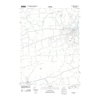
2010 Map of Lewisburg
USGS Topo · Published 2010About this map
Lewisburg and its storied educational and industrial landscape anchor this 2010 survey of Union County. The campus of Bucknell University dominates the eastern bend of the West Branch Susquehanna River, featuring the Art Barn Complex and the Bucknell University Golf Course. The map details a transition from the dense street grids of the borough to the fertile agricultural expanses of Buffalo Valley, where numerous family-named roads like Hoffa Mill Rd and Dreisbach Church Rd trace old farmstead lines.
Find a feature on this map
78 named features on this map. Tap any name to fly to it.
Don’t see what you’re looking for? This feature index may not catch every label — zoom into the map to look around manually.
Map Details
Editions of this 2010 Lewisburg Map
This is the sole edition of this map. No revisions or reprints were ever made.
Other maps of this area

1893 · Sunbury
USGS Topo · 1:62,500

1921 · Williamsport
USGS Topo · 1:48,000

1923 · Williamsport
USGS Topo · 1:62,500

1924 · Milton
USGS Topo · 1:62,500

1938 · Mifflinburg
USGS Topo · 1:48,000

1943 · Sunbury
USGS Topo · 1:62,500

1943 · Mifflinburg
USGS Topo · 1:62,500

1944 · Williamsport
USGS Topo · 1:62,500

1950 · Harrisburg
USGS Topo · 1:250,000
1953 · Mifflinburg
USGS Topo · 1:62,500