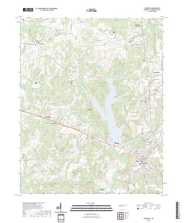
2022 Map of Lexington
USGS Topo · Published 2022About this map
The Lexington landscape is defined by the significant hydrological divide between the Big Sandy River and the Middle Fork Forked Deer River. This 2022 survey captures the modern geography of Henderson County, centered on the county seat and the prominent Beech Lake reservoir. The town’s administrative heart is anchored by the Henderson County Courthouse, while the surrounding countryside reveals a dense network of ancestral sites including Beech River Cem, Antioch Cem, and the Old Hephzibah Cem to the southwest. The presence of Hinson Springs and the Tennessee Valley Divide illustrates the local importance of water and elevation in shaping early settlement patterns and subsequent road development. From the northern junctions of Parker's Crossroads to the southern reach of Beech River, the map provides a comprehensive look at the rural-to-urban transition of this West Tennessee community.
Find a feature on this map
157 named features on this map. Tap any name to fly to it.
Don’t see what you’re looking for? This feature index may not catch every label — zoom into the map to look around manually.
Map Details
Editions of this 2022 Lexington Map
This is the sole edition of this map. No revisions or reprints were ever made.
Other maps of this area

1936 · Clarksburg
USGS Topo · 1:24,000

1936 · Lexington
USGS Topo · 1:24,000

1936 · Yuma
USGS Topo · 1:24,000

1936 · Reagan
USGS Topo · 1:24,000

1936 · Life
USGS Topo · 1:24,000

1936 · Chesterfield
USGS Topo · 1:24,000

1950 · Reagan
USGS Topo · 1:24,000

1950 · Life
USGS Topo · 1:24,000

1950 · Yuma
USGS Topo · 1:24,000

1950 · Lexington
USGS Topo · 1:24,000