
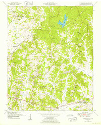
1936 Map of Lexington
USGS Topo · Published 1936About this map
Lexington serves as the focal point of this 1936 survey, showing a concentrated rail and road hub just before the mid-century. The N C & St L railroad and lines like the St Louis and Nashville intersect here, illustrating the town's importance to West Tennessee transport. To the south, the CCC Camp No 496 TVA No 29 reflects New Deal-era infrastructure projects active in the Tennessee Valley. The landscape is defined by the Tennessee Divide Basin, with numerous rural institutions such as Bowling Chapel Antioch Sch and Reedy Grove Ch dotting the countryside. Water management is evident along the Beech River (Drainage Ditch), while small settlements like Bargerton and Timberlake anchor the outlying areas. Family history is preserved through scattered sites like Caffey Cem and Kizer Cem, providing a window into the settled community structure of the Depression era.
Find a feature on this map
50 named features on this map. Tap any name to fly to it.
Don’t see what you’re looking for? This feature index may not catch every label — zoom into the map to look around manually.
Map Details
Editions of this 1936 Lexington Map
This is the sole edition of this map. No revisions or reprints were ever made.
Other maps of this area

1936 · Clarksburg
USGS Topo · 1:24,000

1936 · Yuma
USGS Topo · 1:24,000

1936 · Reagan
USGS Topo · 1:24,000

1936 · Life
USGS Topo · 1:24,000

1936 · Chesterfield
USGS Topo · 1:24,000

1950 · Reagan
USGS Topo · 1:24,000

1950 · Life
USGS Topo · 1:24,000

1950 · Yuma
USGS Topo · 1:24,000

1950 · Lexington
USGS Topo · 1:24,000
1950 · Chesterfield
USGS Topo · 1:24,000