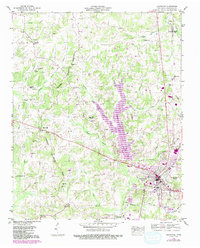
1950 Map of Lexington
USGS Topo · Published 1992About this map
The Tennessee Valley Divide snakes through this landscape, separating the headwaters of the Middle Fork Forked Deer River from the Beech River basin. At the center of the local economy is Lexington, where the concentration of civic life is evident in the Montgomery Sch, a Vocational Sch, and the Franklin-Wilkins Airport. The later expansion of Beech Lake and its accompanying Boat Ramp and Filtration Plant signals the mid-century transformation of the river valley for water management and recreation.
Find a feature on this map
52 named features on this map. Tap any name to fly to it.
Don’t see what you’re looking for? This feature index may not catch every label — zoom into the map to look around manually.
Map Details
Editions of this 1950 Lexington Map
3 editions found
Other maps of this area

1936 · Clarksburg
USGS Topo · 1:24,000

1936 · Lexington
USGS Topo · 1:24,000

1936 · Yuma
USGS Topo · 1:24,000

1936 · Reagan
USGS Topo · 1:24,000

1936 · Life
USGS Topo · 1:24,000

1936 · Chesterfield
USGS Topo · 1:24,000

1950 · Reagan
USGS Topo · 1:24,000

1950 · Life
USGS Topo · 1:24,000

1950 · Yuma
USGS Topo · 1:24,000

1950 · Lexington
USGS Topo · 1:24,000