
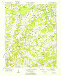
1936 Map of Chesterfield
USGS Topo · Published 1936About this map
The community of Chesterfield and the smaller settlement of Alberton anchor this 1936 survey of Henderson County, Tennessee. The landscape is defined by a dense network of rural infrastructure, including many family-named cemeteries such as Hare Cem and Mc Call Cem, alongside numerous country schools like Timberlake Sch and Reed Sch. The map reveals the early modernizing influence of the Tennessee Electric Power Company Transmission Line and transportation corridors like the N C & St L railroad and State Highway No 20.
Find a feature on this map
41 named features on this map. Tap any name to fly to it.
Don’t see what you’re looking for? This feature index may not catch every label — zoom into the map to look around manually.
Map Details
Editions of this 1936 Chesterfield Map
This is the sole edition of this map. No revisions or reprints were ever made.
Other maps of this area

1936 · Clarksburg
USGS Topo · 1:24,000

1936 · Lexington
USGS Topo · 1:24,000

1936 · Yuma
USGS Topo · 1:24,000

1936 · Scotts Hill
USGS Topo · 1:24,000

1936 · Parsons
USGS Topo · 1:24,000

1936 · Reagan
USGS Topo · 1:24,000

1936 · Cavvia
USGS Topo · 1:24,000

1936 · Life
USGS Topo · 1:24,000

1950 · Reagan
USGS Topo · 1:24,000
1950 · Scotts Hill
USGS Topo · 1:24,000