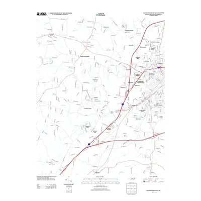
2013 Map of Lexington West
USGS Topo · Published 2013About this map
The western outskirts of Lexington in Davidson County are defined by a dense network of suburban residential developments and critical transportation infrastructure. This 2013 survey documents a period of significant growth, with neighborhoods like Green Needles, Meadowview, and Carolina Pines filling the spaces between established rural communities. The Davidson County Airport serves as a central hub in the south, while the Interstate 85 corridor facilitates regional transit. To the west, the landscape transitions toward agricultural roots at Reeds Crossroads and Tyro, where the terrain is drained by several waterways including N Potts Cr and Swearing Cr. Industrial and commercial history is represented by the village of Erlanger in the northeast. Water features such as Cobles Reservoir, Lingle Lake, and Sapona Lakes are scattered throughout the quadrangle, reflecting the importance of managed water resources for these expanding communities.
Find a feature on this map
62 named features on this map. Tap any name to fly to it.
Don’t see what you’re looking for? This feature index may not catch every label — zoom into the map to look around manually.
Map Details
Editions of this 2013 Lexington West Map
This is the sole edition of this map. No revisions or reprints were ever made.
Other maps of this area

1949 · Denton NW
USGS Topo · 1:24,000

1949 · Eller
USGS Topo · 1:24,000

1950 · Lexington East
USGS Topo · 1:24,000

1950 · Lexington West
USGS Topo · 1:24,000

1950 · Churchland
USGS Topo · 1:24,000

1951 · Churchland
USGS Topo · 1:24,000

1951 · Lexington East
USGS Topo · 1:24,000

1951 · Lexington West
USGS Topo · 1:24,000

1953 · Charlotte
USGS Topo · 1:250,000

1954 · Charlotte
USGS Topo · 1:250,000