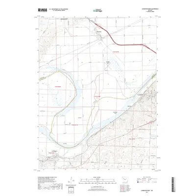
2017 Map of Lexington West
USGS Topo · Published 2017About this map
The Missouri River carves a sweeping path through this river-valley landscape, defining the border between Ray and Lafayette counties. Along the northern bank, the settlement of Henrietta serves as a junction for local roads and the rail corridor, while the city of Richmond sits just to the north. To the south, the terrain rises sharply from the riverbank toward Lexington, where the street grid overlooks Bootlegger Bend.
Find a feature on this map
86 named features on this map. Tap any name to fly to it.
Don’t see what you’re looking for? This feature index may not catch every label — zoom into the map to look around manually.
Map Details
Editions of this 2017 Lexington West Map
This is the sole edition of this map. No revisions or reprints were ever made.
Other maps of this area

1889 · Lexington
USGS Topo · 1:125,000

1894 · Independence
USGS Topo · 1:125,000

1949 · Mayview
USGS Topo · 1:24,000

1949 · Lexington East
USGS Topo · 1:24,000

1949 · Lexington West
USGS Topo · 1:24,000

1949 · Odessa North
USGS Topo · 1:24,000

1950 · Lexington East
USGS Topo · 1:24,000

1950 · Mayview
USGS Topo · 1:24,000

1950 · Kansas City
USGS Topo · 1:250,000

1950 · Odessa North
USGS Topo · 1:24,000