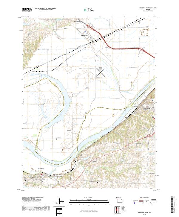
2021 Map of Lexington West
USGS Topo · Published 2021About this map
Lexington and Wellington anchor this survey of the river valley where the Missouri River carves distinct meanders at Bootlegger Bend and Sni Bend. The landscape is a transition from the elevated bluffs of the Lafayette County Courthouse area down to the expansive floodplains of the north bank, where Henrietta sits near several smaller reservoirs like Ray County Number C-21 Lake. This geography influenced the early growth of river-adjacent hamlets such as Myrick and Sunshine.
Find a feature on this map
76 named features on this map. Tap any name to fly to it.
Don’t see what you’re looking for? This feature index may not catch every label — zoom into the map to look around manually.
Map Details
Editions of this 2021 Lexington West Map
This is the sole edition of this map. No revisions or reprints were ever made.
Other maps of this area

1889 · Lexington
USGS Topo · 1:125,000

1894 · Independence
USGS Topo · 1:125,000

1949 · Mayview
USGS Topo · 1:24,000

1949 · Lexington East
USGS Topo · 1:24,000

1949 · Lexington West
USGS Topo · 1:24,000

1949 · Odessa North
USGS Topo · 1:24,000

1950 · Lexington East
USGS Topo · 1:24,000

1950 · Mayview
USGS Topo · 1:24,000

1950 · Kansas City
USGS Topo · 1:250,000

1950 · Odessa North
USGS Topo · 1:24,000