Loading...
Loading map...2022 Map of Liberty
USGS Topo · Published 2022About this map
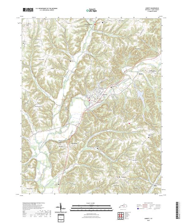
Liberty serves as the central hub of this Casey County landscape, where the Green River winds through a complex network of ridges and hollows. The town's modern character is defined by landmarks like the Casey County Judicial Center and the Somerset Community College Casey Center, reflecting its role as a regional anchor. Surrounding the town, the topography is punctuated by distinct family and location-named heights such as Woodrum Ridge, Rigney Ridge, and Apostolic Ridge.
Find a feature on this map
130 named features on this map. Tap any name to fly to it.
Don’t see what you’re looking for? This feature index may not catch every label — zoom into the map to look around manually.
Map Details
Date Portrayed2022
Date Published2022
PublisherU.S. Geological Survey
Map TypeTopographic
Scale1:24000
Physical Dimensions24 x 29 inches
Editions of this 2022 Liberty Map
This is the sole edition of this map. No revisions or reprints were ever made.
Historical Maps of Moore Through Time
Featured Locations
Source Details
SourceU.S. Geological Survey
CopyrightPublic Domain