Old Maps of Casey County, Kentucky
Explore 117 old maps of Casey County, spanning from 1905 to today. These high-resolution historic maps reveal how streets, neighborhoods, landmarks, and natural features evolved over time — perfect for genealogy, metal detecting, research, and local history exploration.
What you can do with these maps:
- See how Casey County changed over time: Compare historical maps to modern-day views to trace roads, homesites, rail lines & more.
- View detailed metadata: Each map includes creators, publishers, year, scale, and archive source.
- Overlay maps with satellite & LiDAR: Visualize the past alongside modern tools to explore terrain & human change.
- Trusted historical sources: Maps sourced from the USGS, Library of Congress, and other archives.
- Access maps your way: View online, download high-res files, or order prints for personal or research use.
Start exploring old maps of Casey County to uncover forgotten places, hidden landmarks, and the deep history beneath your feet.
Casey County, KY maps
(117)- 1905 Map of Harrodsburg
 1905 Harrodsburg1905 Print · USGSCentral Kentucky's Bluegrass region is captured here in the early twentieth century, showing a landscape defined by the deep gorges of the Kentucky River. Researchers can trace the era's vital rail networks and river commerce through features like Lock No 7 and the Louisville and Nashville RR.3 unique versions available
 - 1935 Map of Somerset
 1935 Somerset1935 Print · USGSIn the mid-1930s, the rural landscapes around Somerset were a dense network of one-room schools and river crossings. Genealogists can trace family connections through numerous landmarks like Mt Zion Sch, Waitsboro Ferry, and the Mills Springs National Cem.
 - 1952 Map of Ellisburg, 1953 Print
 1952 Ellisburg1953 Print · USGSCasey County's high ridges and creek bottoms are captured here in the early fifties, showing a rural landscape organized around small family farms and community centers. Researchers can trace ancestral locations through numerous sites like Peytons Store, Atwood Chapel, and the Martin Creek Sch.3 unique versions available
 - 1952 Map of Eubank, 1953 Print
 1952 Eubank1953 Print · USGSThe Eubank area and the southern Lincoln County borderlands appear here in the early fifties, following the path of the Southern railroad. Researchers can trace rural lineages through numerous landmarks like Phillips Chapel, Double Spring Cem, and Walnut Grove Sch.
 - 1952 Map of Hustonville, 1953 Print
 1952 Hustonville1953 Print · USGSCentral Kentucky's rural landscape at the dawn of the 1950s shows a region of small farm hubs and railroad towns. Genealogists can trace local roots at Kidds Store, the SOUTHERN railroad stop in Mc Kinney, and schools like Stapp Sch.3 unique versions available
 - 1952 Map of Clementsville, 1953 Print
 1952 Clementsville1953 Print · USGSCasey County in the early fifties is mapped here as a labyrinth of high ridges and creek-bottom settlements. Genealogists and historians can trace family roots through numerous highland schools and churches, including Casey Creek Sch, White Oak Ch, and the Noel Chapel Cem.4 unique versions available
 - 1952 Map of Liberty, 1953 Print
 1952 Liberty1953 Print · USGSThe Green River valley in the early fifties shows a landscape of ridge-top schools and creek-side settlements. Genealogists can trace family roots through numerous sites like Walnut Hill Sch, Poplar Springs Ch, and the community at Lanhamtown.2 unique versions available
 - 1952 Map of Yosemite, 1953 Print
 1952 Yosemite1953 Print · USGSIn the early fifties, the hilly terrain of Casey County was dotted with family-named ridges and small country schools. Genealogists can trace rural life through landmarks like Old Willow Springs Cem, Freedom Sch, and Middleburg.3 unique versions available
 - 1952 Map of Junction City, 1954 Print
 1952 Junction City1954 Print · USGSCentral Kentucky's rail-and-river landscape is captured here in the early fifties, where the Southern and L&N lines intersect. Genealogists can trace family landmarks like Goodall Airfield, Gray Cem, and the rural community of Milledgeville before modern development shifted the region.2 unique versions available
 - 1952 Map of Mannsville, 1954 Print
 1952 Mannsville1954 Print · USGSThe Taylor and Casey County borderlands are documented here at mid-century, showing a landscape of high ridges and rural settlements. Genealogists can locate family-named landmarks and institutions like Gaddis Ridge Cem, Farmers Sch, and Mt Zion Ch.2 unique versions available
 - 1952 Map of Bradfordsville, 1954 Print
 1952 Bradfordsville1954 Print · USGSThe forks of the Rolling Fork river in the early fifties define this central Kentucky landscape. Genealogists and local historians can trace rural school districts and family cemeteries near Bradfordsville, Merrimac, and the ridges of Muldraugh Hill.2 unique versions available
 - 1952 Map of Parksville, 1954 Print
 1952 Parksville1954 Print · USGSBoyle and Casey counties come together in the early fifties among the steep ridges and hollows of the Knobs. Genealogists can trace family lines through numerous rural landmarks like Shoehammer Sch (Shoehammer Cem), Mitchellsburg, and Forkland.
 - 1953 Map of Bradfordsville NE, 1954 Print
 1953 Bradfordsville NE1954 Print · USGSMarion and Casey counties in the early fifties are shown here as a landscape of ridge-top boundaries and valley settlements. Genealogists can trace family roots through landmarks like Weatherford Cem, McFarland Sch, and the community at Jacktown.2 unique versions available
 - 1953 Map of Phil, 1954 Print
 1953 Phil1954 Print · USGSCasey County in the early fifties is captured here as a landscape of interconnected ridges and hollows. Researchers can trace rural life through numerous country schools and churches like Tate Sch, Antioch Ch, and the historic Rubert Ford river crossing.2 unique versions available
 - 1953 Map of Gravel Switch, 1954 Print
 1953 Gravel Switch1954 Print · USGSMarion County and the surrounding knobs are shown here in the mid-1950s as rural life centered on the Louisville and Nashville rail line. Researchers can trace family roots through numerous landmarks like Aliceton Cem, Doctors Fork Ch, and the Jane Todd Crawford Trail.
 - 1953 Map of Mintonville, 1955 Print
 1953 Mintonville1955 Print · USGSThe Casey and Pulaski County line comes alive in the early fifties, showing a rural Kentucky landscape of ridge-top schools and creek-side settlements. Genealogists can locate family landmarks like Cains Store, Bradley Pleasure Church, and the Caintown Cemetery.3 unique versions available
 - 1953 Map of Dunnville, 1955 Print
 1953 Dunnville1955 Print · USGSThe Green River valley and the rural ridges of Adair and Casey Counties are frozen in time here during the early fifties. Genealogists can trace family landmarks across the landscape, from Millerfield to country schools like Poplar Grove Sch and Tarter Sch.2 unique versions available
 - 1953 Map of Bradfordsville, 1976 Print
 1953 Bradfordsville1976 Print · USGSThe rural borders of Marion, Casey, and Taylor counties are captured here in the early fifties during a time of small-town schoolhouses and country churches. Researchers can trace family roots at Pine Grove Sch, Shreve Cem, and the settlement of Jacktown.
 - 1954 Map of Science Hill, 1955 Print
 1954 Science Hill1955 Print · USGSMid-century Pulaski County is defined here by the Southern railroad line and a dense network of ridge-top farms and schools. Researchers can trace family history through dozens of localized landmarks like Center Post Sch, Freedom Ch, and the Van Hook Cem.
 - 1954 Map of Eli, 1956 Print
 1954 Eli1956 Print · USGSThe Russell County ridge country is captured here in the mid-fifties as the waters of Lake Cumberland filled the deep hollows. Researchers can trace rural life through numerous landmarks like Irvins Store, the Cedar Springs Ch, and Sunshine Sch.2 unique versions available
 - 1957 Map of Winchester, 1968 Print
 1957 Winchester1968 Print · USGSCentral Kentucky's landscape in the mid-twentieth century features the sprawling Fort Knox and the early parkway system. Genealogists and historians can trace rail lines like the Southern Railway and find landmarks from Bernheim Forest to Pilot Knob.3 unique versions available
 - 1960 Map of Winchester
 1960 Winchester1960 Print · USGSCentral Kentucky's diverse landscape is shown here at mid-century, from the bluegrass plains to the rugged Pottsville Escarpment. Genealogists and historians can trace the rail-and-river network connecting towns like Bardstown and Stanford alongside landmarks like Lake Cumberland.
 - 1961 Map of Science Hill, 1962 Print
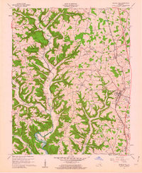 1961 Science Hill1962 Print · USGSThe rural landscapes of northern Pulaski County are captured in the early sixties as the Southern railroad connects small Kentucky towns. Researchers can trace family history through numerous landmarks like Center Post Ch, Science Hill Cem, and Hogue Sch.2 unique versions available
 - 1961 Map of Eubank, 1962 Print
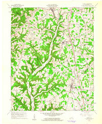 1961 Eubank1962 Print · USGSThe rural landscapes of Lincoln and Pulaski counties come alive in this early 1960s record of the Cumberland plateau. Genealogists can trace homesteads and local landmarks like Double Spring Cem, Phillips Chapel, and the old Pond Sch site.2 unique versions available
 - 1970 Map of Dunnville, 1972 Print
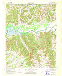 1970 Dunnville1972 Print · USGSAdair and Casey counties appear during the early 1970s as the Green River Lake reservoir reshapes the valley. Researchers can find numerous family burial grounds and country churches like Williams Cem, Shady Grove Ch, and the Mt Calvary Cem Ch.
Showing maps 1-25 of 117
Top cities of Casey County
Frequently asked questions
- What are the different types of historical maps available for Casey County?
- What is the oldest map of Casey County?
- Where can I purchase historical maps of Casey County for my home or office?
- Where can I download high-res historical maps of Casey County?
- Are there historical topographic maps available for Casey County?
- Is there historical aerial imagery available for Casey County?
- Where are historical maps of Casey County sourced from?