
1953 Map of Dunnville
USGS Topo · Published 1955About this map
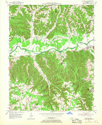
The Green River carves a broad valley through the center of this terrain, separating the winding ridges of Casey, Adair, and Russell Counties in the early 1950s. The settlement of Dunnville sits along the river's north bank at the eastern edge, while Pellyton occupies the central flats near KY 206. This survey reveals a deeply local landscape where education and faith were distributed across several ridgelines, evidenced by the numerous small schoolhouses like Blair Ridge Sch and Red Hill Sch. The area south of the river is particularly dense with family-named topography such as Millerfield Ridge and the Damron Creek drainage. Tracing the county lines shows how these political boundaries followed the crests of high ground like Abney Ridge, while local life centered on the small rural post offices and country churches like Barnett Creek Ch and Norman Chapel.
Find a feature on this map
49 named features on this map. Tap any name to fly to it.
Don’t see what you’re looking for? This feature index may not catch every label — zoom into the map to look around manually.
Map Details
Editions of this 1953 Dunnville Map
2 editions found
Other maps of this area

1952 · Clementsville
USGS Topo · 1:24,000

1952 · Liberty
USGS Topo · 1:24,000

1952 · Mannsville
USGS Topo · 1:24,000

1953 · Phil
USGS Topo · 1:24,000

1953 · Montpelier
USGS Topo · 1:24,000

1954 · Knifley
USGS Topo · 1:24,000

1954 · Russell Springs
USGS Topo · 1:24,000

1954 · Eli
USGS Topo · 1:24,000

1957 · Winchester
USGS Topo · 1:250,000

1960 · Winchester
USGS Topo · 1:250,000