
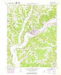
1952 Map of Liberty
USGS Topo · Published 1953About this map
The Green River carves a winding path through this central Kentucky landscape, anchoring the development of Liberty and several outlying rural communities. This early 1950s survey captures a dense network of one-room schoolhouses and country churches that defined local life before widespread consolidation. Named schools such as Hopewell Sch, Brush Creek Sch, and Murphy Sch are situated along the ridges and hollows, while family and community sites like Glenwood Cem and Moore Cem provide valuable touchstones for genealogical research.
Find a feature on this map
54 named features on this map. Tap any name to fly to it.
Don’t see what you’re looking for? This feature index may not catch every label — zoom into the map to look around manually.
Map Details
Editions of this 1952 Liberty Map
2 editions found
Other maps of this area

1952 · Ellisburg
USGS Topo · 1:24,000

1952 · Hustonville
USGS Topo · 1:24,000

1952 · Clementsville
USGS Topo · 1:24,000

1952 · Yosemite
USGS Topo · 1:24,000

1953 · Bradfordsville NE
USGS Topo · 1:24,000

1953 · Phil
USGS Topo · 1:24,000

1953 · Mintonville
USGS Topo · 1:24,000

1953 · Dunnville
USGS Topo · 1:24,000

1957 · Winchester
USGS Topo · 1:250,000

1960 · Winchester
USGS Topo · 1:250,000