
1952 Map of Clementsville
USGS Topo · Published 1953About this map
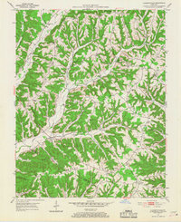
Gizard Ridge and Tennessee Ridge dominate this Casey County landscape, where winding hollows and steep elevations dictated the placement of dozens of rural institutions in the early 1950s. The settlement of Clementsville sits at a low point along Casey Creek, serving as a central hub for the surrounding ridges. Higher up, the map records a dense network of country schools like Sulphur Run Sch and Pennington Sch, many located on the finger ridges themselves to serve isolated farmsteads.
Find a feature on this map
61 named features on this map. Tap any name to fly to it.
Don’t see what you’re looking for? This feature index may not catch every label — zoom into the map to look around manually.
Map Details
Editions of this 1952 Clementsville Map
4 editions found
Other maps of this area

1952 · Ellisburg
USGS Topo · 1:24,000

1952 · Liberty
USGS Topo · 1:24,000

1952 · Mannsville
USGS Topo · 1:24,000

1952 · Bradfordsville
USGS Topo · 1:24,000

1953 · Bradfordsville NE
USGS Topo · 1:24,000

1953 · Phil
USGS Topo · 1:24,000

1953 · Dunnville
USGS Topo · 1:24,000

1953 · Bradfordsville
USGS Topo · 1:24,000

1954 · Knifley
USGS Topo · 1:24,000

1957 · Winchester
USGS Topo · 1:250,000