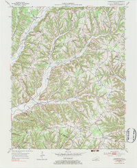
1952 Map of Clementsville
USGS Topo · Published 1983About this map
Clementsville serves as a central hub in this landscape of winding ridges and deep hollows along the border of Casey and Adair counties. The terrain is defined by a dense network of local schools and churches that once anchored these rural communities, including Noel Chapel Sch and the Foster Sch. Genealogists will find numerous family-named landmarks and small burial grounds like Gilpin Cem and Whited Cem scattered across the high ground of Gunnard Ridge and Pennington Ridge.
Find a feature on this map
60 named features on this map. Tap any name to fly to it.
Don’t see what you’re looking for? This feature index may not catch every label — zoom into the map to look around manually.
Map Details
Editions of this 1952 Clementsville Map
4 editions found
Other maps of this area

1952 · Ellisburg
USGS Topo · 1:24,000

1952 · Clementsville
USGS Topo · 1:24,000

1952 · Liberty
USGS Topo · 1:24,000

1952 · Mannsville
USGS Topo · 1:24,000

1952 · Bradfordsville
USGS Topo · 1:24,000

1953 · Bradfordsville NE
USGS Topo · 1:24,000

1953 · Phil
USGS Topo · 1:24,000

1953 · Dunnville
USGS Topo · 1:24,000

1953 · Bradfordsville
USGS Topo · 1:24,000

1954 · Knifley
USGS Topo · 1:24,000