
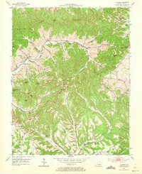
1952 Map of Ellisburg
USGS Topo · Published 1953About this map
Ellisburg and the rural crossroads of Peytons Store serve as the primary hubs in this mid-century look at Casey County's ridge-and-hollow terrain. The landscape is defined by long, winding elevations like Dividing Ridge and Peyton Ridge, where local life is organized around numerous one-room schools and country churches. Educational life is well-documented with sites like Rocky Ford Sch and Chelf Sch, while spiritual centers such as Oak Grove Ch and the Brush Creek Tabernacle anchor the small farming communities.
Find a feature on this map
55 named features on this map. Tap any name to fly to it.
Don’t see what you’re looking for? This feature index may not catch every label — zoom into the map to look around manually.
Map Details
Editions of this 1952 Ellisburg Map
3 editions found
Other maps of this area

1905 · Harrodsburg
USGS Topo · 1:125,000

1952 · Hustonville
USGS Topo · 1:24,000

1952 · Clementsville
USGS Topo · 1:24,000

1952 · Liberty
USGS Topo · 1:24,000

1952 · Yosemite
USGS Topo · 1:24,000

1952 · Junction City
USGS Topo · 1:24,000

1952 · Parksville
USGS Topo · 1:24,000

1953 · Bradfordsville NE
USGS Topo · 1:24,000

1953 · Gravel Switch
USGS Topo · 1:24,000

1957 · Winchester
USGS Topo · 1:250,000