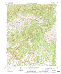
1952 Map of Ellisburg
USGS Topo · Published 1987About this map
Dividing Ridge and Bark Ridge dominate this corner of Casey County, where the headwaters of several drainages carve a complex system of hollows and gaps. The local geography is anchored by small rural centers such as Ellisburg and Peytons Store, which served as hubs for the surrounding farmsteads and school districts. The 1952 landscape reveals a community structure built around education and faith, with numerous small schoolhouses like Cochran Sch and Shelf Sch alongside remote houses of worship including Atwood Chapel and the Brush Creek Tabernacle.
Find a feature on this map
53 named features on this map. Tap any name to fly to it.
Don’t see what you’re looking for? This feature index may not catch every label — zoom into the map to look around manually.
Map Details
Editions of this 1952 Ellisburg Map
3 editions found
Other maps of this area

1905 · Harrodsburg
USGS Topo · 1:125,000

1952 · Ellisburg
USGS Topo · 1:24,000

1952 · Hustonville
USGS Topo · 1:24,000

1952 · Clementsville
USGS Topo · 1:24,000

1952 · Liberty
USGS Topo · 1:24,000

1952 · Yosemite
USGS Topo · 1:24,000

1952 · Junction City
USGS Topo · 1:24,000

1952 · Parksville
USGS Topo · 1:24,000

1953 · Bradfordsville NE
USGS Topo · 1:24,000

1953 · Gravel Switch
USGS Topo · 1:24,000