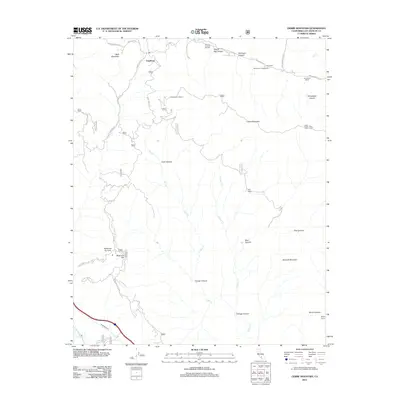
2012 Map of Liebre Mountain
USGS Topo · Published 2012About this map
Sandberg and the Rancho Corona Del Valle occupy a high-elevation landscape characterized by deep drainage systems and mountain ridges. The terrain is marked by the winding path of Ridge Route Rd and Bald Mountain Rd, reflecting the complex transportation history of this part of the Sierra Pelona. From the West Liebre Lookout atop Liebre Mountain, the map shows a network of forest service roads and trails, including the Horse Trail, that connect isolated sites like the Kelly Ranch and Pine Grove Ranch. Below the surface, the Angeles Tunnel cuts through the bedrock near Piru Cr, part of the region's massive water infrastructure. Canyons such as Poison Oak Canyon and Trough Canyon feed into the major local arteries of Salt Cr and Castaic Cr.
Find a feature on this map
45 named features on this map. Tap any name to fly to it.
Don’t see what you’re looking for? This feature index may not catch every label — zoom into the map to look around manually.
Map Details
Editions of this 2012 Liebre Mountain Map
This is the sole edition of this map. No revisions or reprints were ever made.
Other maps of this area

1903 · Tejon
USGS Topo · 1:125,000

1931 · Redrock Mtn
USGS Topo · 1:24,000

1932 · Beartrap Canyon
USGS Topo · 1:24,000

1932 · Neenach
USGS Topo · 1:24,000

1933 · Quail
USGS Topo · 1:24,000
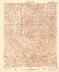
1936 · Redrock Mtn.
USGS Topo · 1:24,000

1938 · Beartrap Canyon
USGS Topo · 1:24,000

1938 · Liebre
USGS Topo · 1:24,000

1938 · Quail
USGS Topo · 1:24,000

1943 · Neenach
USGS Topo · 1:62,500