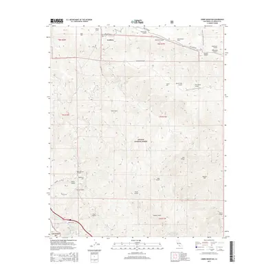
2015 Map of Liebre Mountain
USGS Topo · Published 2015About this map
Sandberg sits at the northern edge of this high-elevation landscape, where the legendary San Andreas Fault cuts a distinct line across the terrain. The northern section is dominated by significant ridgelines and deep canyons such as Liebre Gulch and Poison Oak Canyon, leading up to the prominent Liebre Mtn. This area serves as a critical corridor for both natural and man-made infrastructure, featuring the winding path of the Pacific Crest National Scenic Trail and the massive engineering of the Governor Edmund G Brown Jr California Aqueduct. To the south, the terrain drops toward the Angeles Tunnel and Quarry Spring, revealing a complex network of drainages like Castaic Cr and Osito Canyon. The map provides an essential view of how modern water management and recreation coexist within the high-relief geography of the Angeles National Forest.
Find a feature on this map
42 named features on this map. Tap any name to fly to it.
Don’t see what you’re looking for? This feature index may not catch every label — zoom into the map to look around manually.
Map Details
Editions of this 2015 Liebre Mountain Map
This is the sole edition of this map. No revisions or reprints were ever made.
Other maps of this area

1903 · Tejon
USGS Topo · 1:125,000

1931 · Redrock Mtn
USGS Topo · 1:24,000

1932 · Beartrap Canyon
USGS Topo · 1:24,000

1932 · Neenach
USGS Topo · 1:24,000

1933 · Quail
USGS Topo · 1:24,000
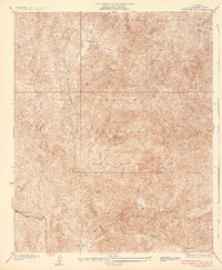
1936 · Redrock Mtn.
USGS Topo · 1:24,000

1938 · Beartrap Canyon
USGS Topo · 1:24,000

1938 · Liebre
USGS Topo · 1:24,000

1938 · Quail
USGS Topo · 1:24,000

1943 · Neenach
USGS Topo · 1:62,500