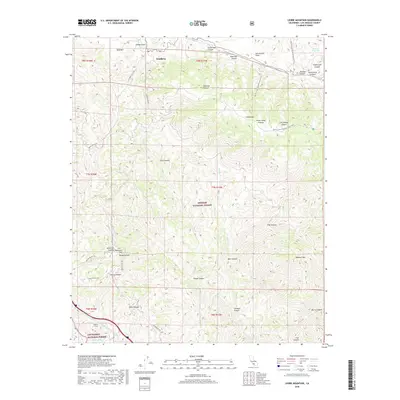
2018 Map of Liebre Mountain
USGS Topo · Published 2018About this map
The San Andreas Fault cuts across the northern reaches of this landscape, marking the geological boundary within the Angeles National Forest. The small settlement of Sandberg sits high in the northwest, serving as a landmark along the historic Ridge Route Rd. This area is defined by its dramatic elevation changes, from the heights of Liebre Mtn and Bald Mtn down through steep drainages like Poison Oak Canyon and Bear Canyon.
Find a feature on this map
47 named features on this map. Tap any name to fly to it.
Don’t see what you’re looking for? This feature index may not catch every label — zoom into the map to look around manually.
Map Details
Editions of this 2018 Liebre Mountain Map
This is the sole edition of this map. No revisions or reprints were ever made.
Other maps of this area

1903 · Tejon
USGS Topo · 1:125,000

1931 · Redrock Mtn
USGS Topo · 1:24,000

1932 · Beartrap Canyon
USGS Topo · 1:24,000

1932 · Neenach
USGS Topo · 1:24,000

1933 · Quail
USGS Topo · 1:24,000
1936 · Redrock Mtn.
USGS Topo · 1:24,000

1938 · Beartrap Canyon
USGS Topo · 1:24,000

1938 · Liebre
USGS Topo · 1:24,000

1938 · Quail
USGS Topo · 1:24,000

1943 · Neenach
USGS Topo · 1:62,500