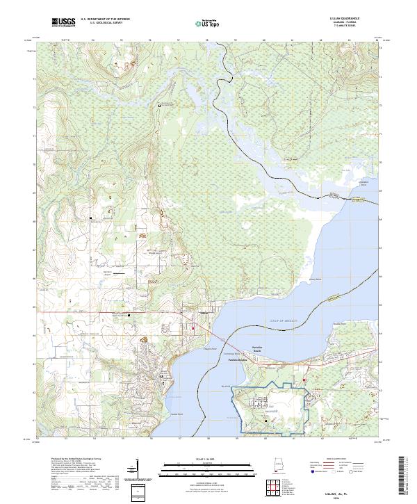
2024 Map of Lillian
USGS Topo · Published 2024About this map
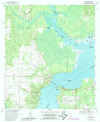
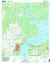
The Perdido River forms the vital boundary between Baldwin and Escambia counties, marking the state line where Florida and Alabama meet. The community of Lillian serves as a focal point overlooking Perdido Bay, surrounded by a landscape defined by significant water features like Blackwater River and Kinsey Bayou. Local heritage is anchored by several burial grounds, including the historic Old Spanish Cem and the New Mount Marriah Baptist Church Cem, which reflect the area's long-standing settlement patterns.
Find a feature on this map
121 named features on this map. Tap any name to fly to it.
Don’t see what you’re looking for? This feature index may not catch every label — zoom into the map to look around manually.
Map Details
Editions of this 2024 Lillian Map
This is the sole edition of this map. No revisions or reprints were ever made.
Historical Maps of Escambia County Through Time
3 maps found