Loading...
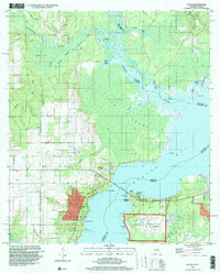
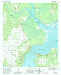
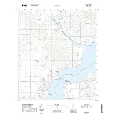
Loading map...1994 Map of Lillian
USGS Topo · Published 1999About this map
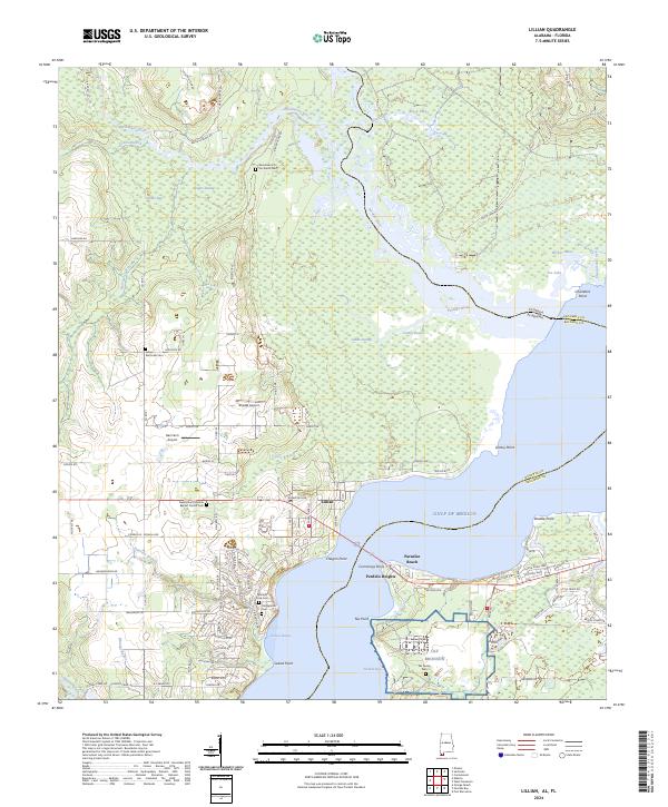
Lillian serves as the focal point of this coastal survey, situated on the western bank where the Lillian Bridge crosses into Florida. The landscape is defined by the transition from the winding Perdido River and its dense southern swamp into the expansive waters of Perdido Bay. Local history is preserved at the Old Spanish Cem and St Joseph Ch, while the southern shore is marked by the aviation infrastructure of Pensacola NAS OLF Bronson, including notable Seaplane Ramps.
Find a feature on this map
41 named features on this map. Tap any name to fly to it.
Don’t see what you’re looking for? This feature index may not catch every label — zoom into the map to look around manually.
Map Details
Date Portrayed1994
Date Published1999
PublisherU.S. Geological Survey
Map TypeTopographic
Scale1:24,000
Physical Dimensions21.6 x 26.8 inches
Editions of this 1994 Lillian Map
This is the sole edition of this map. No revisions or reprints were ever made.
Historical Maps of Lillian Through Time
7 maps found

Featured Locations
Source Details
SourceU.S. Geological Survey
CopyrightPublic Domain