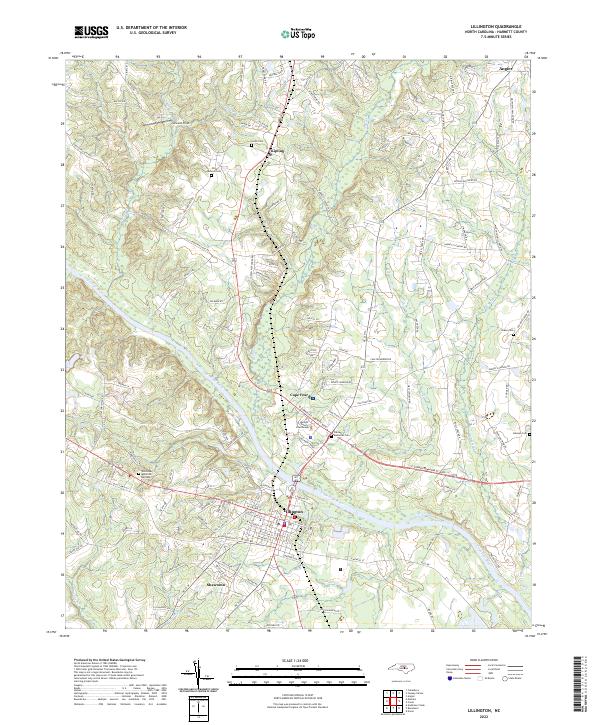
2022 Map of Lillington
USGS Topo · Published 2022About this map
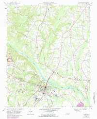
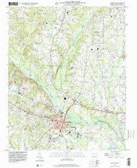
Lillington serves as the focal point of this Harnett County survey, situated along the southern banks of the winding Cape Fear River. The landscape is characterized by its transition from the town's grid to the surrounding rural hamlets of Kipling and Shawtown. Significant local history is anchored at the Harnett County Courthouse, while numerous family and community burial grounds, such as Smith Cem and the Olive Branch Cem, are scattered across the terrain. These features, along with Harnett Memorial Cem, provide essential data points for genealogical research in the region.
Find a feature on this map
139 named features on this map. Tap any name to fly to it.
Don’t see what you’re looking for? This feature index may not catch every label — zoom into the map to look around manually.
Map Details
Editions of this 2022 Lillington Map
This is the sole edition of this map. No revisions or reprints were ever made.
Historical Maps of Angier Through Time
3 maps found