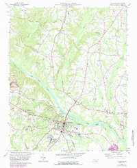
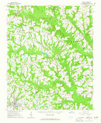
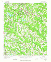
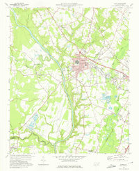
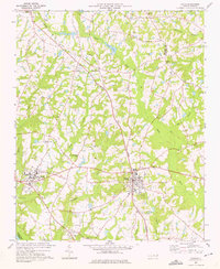
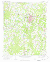
1978 Map of Lillington
USGS Topo · Published 1987About this map
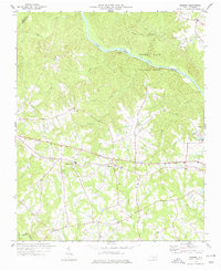
The Cape Fear River serves as the central artery for this part of Harnett County, winding southeast through a landscape defined by small communities and light industry during the late 1970s and 1980s. The county seat, Lillington, sits prominently at a bend in the river, showing a developed street grid that transitions into the adjacent Shawtown neighborhood. This map captures the region's infrastructure just as it was being modernized, including the Norfolk Southern railway line and the Tirzah Airport to the west. Scattered throughout the rural uplands are numerous historic congregations and cemeteries, such as Summerville Ch, Olive Branch Ch, and the Harnett Memorial Cem. Traces of the local extraction economy are visible in the Claypits and Sandpit near the riverbanks, alongside institutional landmarks like the Lafayette Sch and several local trailer parks.
Find a feature on this map
41 named features on this map. Tap any name to fly to it.
Don’t see what you’re looking for? This feature index may not catch every label — zoom into the map to look around manually.
Map Details
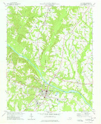
Editions of this 1978 Lillington Map
2 editions found
Other maps of this area

1953 · Raleigh
USGS Topo · 1:250,000

1954 · Raleigh
USGS Topo · 1:250,000
1956 · Anderson Creek
USGS Topo · 1:24,000
1956 · Bunnlevel
USGS Topo · 1:24,000
1964 · Angier
USGS Topo · 1:24,000
1964 · Garner
USGS Topo · 1:62,500
1973 · Erwin
USGS Topo · 1:24,000
1973 · Coats
USGS Topo · 1:24,000
1974 · Fuquay-Varina
USGS Topo · 1:24,000
1974 · Mamers
USGS Topo · 1:24,000