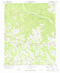
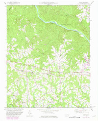
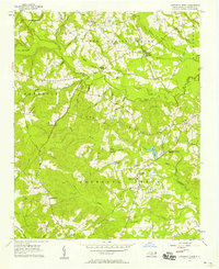
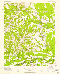
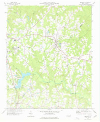
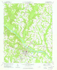
1974 Map of Mamers
USGS Topo · Published 1977About this map
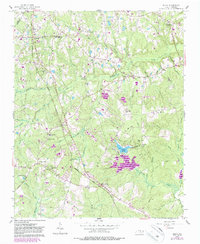
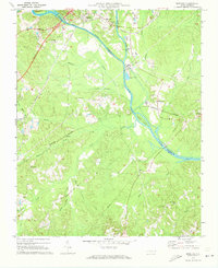
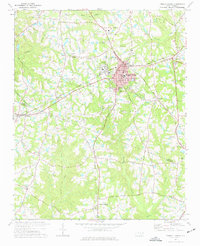
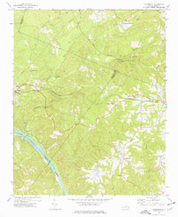
Raven Rock State Park anchors the northern portion of this Harnett County landscape, where the Cape Fear River winds past Lanier Falls. The terrain is defined by a dense network of tributaries including Avents Creek, Camels Creek, and Walkers Creek, which carve through the rural countryside. Small community centers such as Mamers and Boone Trail are interconnected by a system of light-duty roads, reflecting a late-20th-century rural settlement pattern centered on crossroad hamlets and local parish life.
Find a feature on this map
29 named features on this map. Tap any name to fly to it.
Don’t see what you’re looking for? This feature index may not catch every label — zoom into the map to look around manually.
Map Details
Editions of this 1974 Mamers Map
2 editions found
Other maps of this area

1953 · Raleigh
USGS Topo · 1:250,000

1954 · Raleigh
USGS Topo · 1:250,000
1956 · Anderson Creek
USGS Topo · 1:24,000
1956 · Bunnlevel
USGS Topo · 1:24,000
1957 · Olivia
USGS Topo · 1:24,000
1970 · Moncure
USGS Topo · 1:24,000
1974 · Fuquay-Varina
USGS Topo · 1:24,000
1974 · Cokesbury
USGS Topo · 1:24,000
1977 · Broadway
USGS Topo · 1:24,000
1978 · Lillington
USGS Topo · 1:24,000