
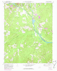
1970 Map of Moncure
USGS Topo · Published 1973About this map
The confluence of the Haw River and Deep River forms the Cape Fear River at the heart of this 1970 survey, a vital hydrological junction that defined the settlement of southeastern Chatham County. Industrial development is prominent along the banks, featuring a powerplant, substation, and several industrial waste ponds near Moncure. This infrastructure exists alongside a traditional rural landscape marked by numerous country houses of worship, including Rose Hill Ch, Memphis Ch, and New England Ch.
Find a feature on this map
42 named features on this map. Tap any name to fly to it.
Don’t see what you’re looking for? This feature index may not catch every label — zoom into the map to look around manually.
Map Details
Editions of this 1970 Moncure Map
2 editions found
Other maps of this area

1953 · Raleigh
USGS Topo · 1:250,000

1954 · Raleigh
USGS Topo · 1:250,000

1969 · New Hope Dam
USGS Topo · 1:24,000

1970 · Pittsboro
USGS Topo · 1:24,000

1970 · Colon
USGS Topo · 1:24,000
1974 · New Hill
USGS Topo · 1:24,000

1974 · Mamers
USGS Topo · 1:24,000
1974 · Cokesbury
USGS Topo · 1:24,000

1974 · Sanford
USGS Topo · 1:24,000
1977 · Broadway
USGS Topo · 1:24,000