
1970 Map of Pittsboro
USGS Topo · Published 1973About this map
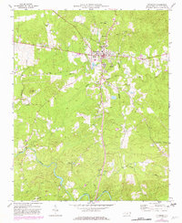
Pittsboro stands at the center of this 1970s topographic study, revealing a community balanced between its rural roots and mid-century infrastructure. The landscape is dotted with numerous small country churches that served as anchors for the surrounding countryside, including Old Rock Spring Ch, Alston Chapel, and Mitchell Chapel. Educational sites like Horton High Sch reflect the town's social core, while industrial footprints such as the Seaboard Coast Line and a nearby Substation trace the reach of regional transport and power. To the south, the terrain descends toward the winding Rocky River, joined by tributaries like Stinking Creek and Bear Creek. Notable landmarks such as Round Top Mtn and the Lookout Tower punctuate the high ground, providing a detailed look at the Chatham County topography before more modern development altered the rural character of the North Carolina Piedmont.
Find a feature on this map
26 named features on this map. Tap any name to fly to it.
Don’t see what you’re looking for? This feature index may not catch every label — zoom into the map to look around manually.
Map Details
Editions of this 1970 Pittsboro Map
2 editions found
Other maps of this area

1951 · Farrington
USGS Topo · 1:24,000

1953 · Raleigh
USGS Topo · 1:250,000

1954 · Raleigh
USGS Topo · 1:250,000

1968 · Bynum
USGS Topo · 1:24,000

1969 · New Hope Dam
USGS Topo · 1:24,000

1970 · Goldston
USGS Topo · 1:24,000

1970 · Colon
USGS Topo · 1:24,000

1970 · Moncure
USGS Topo · 1:24,000

1970 · Siler City NE
USGS Topo · 1:24,000

1974 · Silk Hope
USGS Topo · 1:24,000