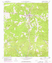
1970 Map of Pittsboro
USGS Topo · Published 1982About this map
Pittsboro stands at the heart of this Chatham County landscape, serving as a hub for the surrounding rural communities during a period of steady growth and revision. The town's layout is anchored by local institutions like the Horton High Sch, while the outlying areas are defined by a network of traditional country churches. These congregations, including Mitchell Chapel, Old Rock Spring Ch, and Belmont Ch, reflect the deep-rooted social and genealogical history of the North Carolina piedmont.
Find a feature on this map
22 named features on this map. Tap any name to fly to it.
Don’t see what you’re looking for? This feature index may not catch every label — zoom into the map to look around manually.
Map Details
Editions of this 1970 Pittsboro Map
2 editions found
Other maps of this area

1951 · Farrington
USGS Topo · 1:24,000

1953 · Raleigh
USGS Topo · 1:250,000

1954 · Raleigh
USGS Topo · 1:250,000

1968 · Bynum
USGS Topo · 1:24,000

1969 · New Hope Dam
USGS Topo · 1:24,000

1970 · Goldston
USGS Topo · 1:24,000

1970 · Pittsboro
USGS Topo · 1:24,000

1970 · Colon
USGS Topo · 1:24,000

1970 · Moncure
USGS Topo · 1:24,000

1970 · Siler City NE
USGS Topo · 1:24,000