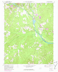
1970 Map of Moncure
USGS Topo · Published 1982About this map
Deep River and the Haw River converge to form the Cape Fear River at the heart of this North Carolina survey, marking a significant hydrologic and industrial junction near the Chatham and Lee county line. The settlement of Moncure serves as a local hub, flanked by the older community of Haywood and the industrial activity of the Brickhaven area. The landscape is defined by the heavy presence of rail infrastructure, including the Seaboard Coast Line and Norfolk Southern, which supported the region's transport and utility needs, such as the Powerplant and Substation near McKay Island. Genealogists will find a wealth of named local landmarks, including several rural congregations like Rose Hill Ch, Zion Ch, and Lee Chapel, alongside the Ward Memorial Sch. The presence of an old Copper Mine near the Gibbons family area points to the diverse industrial history of the Cape Fear headwaters during the mid-to-late 20th century.
Find a feature on this map
44 named features on this map. Tap any name to fly to it.
Don’t see what you’re looking for? This feature index may not catch every label — zoom into the map to look around manually.
Map Details
Editions of this 1970 Moncure Map
2 editions found
Other maps of this area

1953 · Raleigh
USGS Topo · 1:250,000

1954 · Raleigh
USGS Topo · 1:250,000

1969 · New Hope Dam
USGS Topo · 1:24,000

1970 · Pittsboro
USGS Topo · 1:24,000

1970 · Colon
USGS Topo · 1:24,000

1970 · Moncure
USGS Topo · 1:24,000
1974 · New Hill
USGS Topo · 1:24,000

1974 · Mamers
USGS Topo · 1:24,000
1974 · Cokesbury
USGS Topo · 1:24,000

1974 · Sanford
USGS Topo · 1:24,000