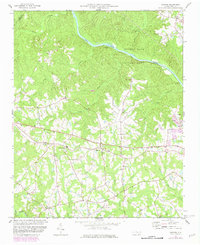
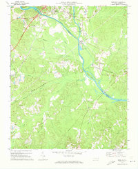
1974 Map of Mamers
USGS Topo · Published 1982About this map
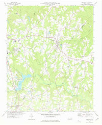
Raven Rock State Park anchors the northern landscape where the Cape Fear River cuts through the terrain, featuring landmarks like Lanier Falls. The central portion of this survey is dominated by the rural community of Mamers and the settlement of Boone Trail. The area is characterized by a dense network of country roads and numerous community centers, evidenced by several rural congregations including Moore Union Ch, Antioch Ch, and Chapel Hill Ch. To the south, the Upper Little River and its tributaries like Jones Creek define the drainage patterns of the coastal plain. In the east, small-scale industrial activity is noted at a Sandpit near Luart. This map captures a period of growth in Harnett County, with purple photorevisions from 1981 indicating evolving road patterns and building footprints in the years following the original 1974 field check.
Find a feature on this map
27 named features on this map. Tap any name to fly to it.
Don’t see what you’re looking for? This feature index may not catch every label — zoom into the map to look around manually.
Map Details
Editions of this 1974 Mamers Map
2 editions found
Other maps of this area

1953 · Raleigh
USGS Topo · 1:250,000

1954 · Raleigh
USGS Topo · 1:250,000
1956 · Anderson Creek
USGS Topo · 1:24,000
1956 · Bunnlevel
USGS Topo · 1:24,000
1957 · Olivia
USGS Topo · 1:24,000
1970 · Moncure
USGS Topo · 1:24,000
1974 · Fuquay-Varina
USGS Topo · 1:24,000
1974 · Mamers
USGS Topo · 1:24,000
1974 · Cokesbury
USGS Topo · 1:24,000
1977 · Broadway
USGS Topo · 1:24,000