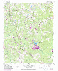
1957 Map of Olivia
USGS Topo · Published 1986About this map
Olivia and Johnsonville serve as key hubs in this portion of Harnett County, defined by a transition from agricultural settlements to the early suburban and recreational developments of the mid-20th century. The Seaboard Coast Line Railroad cuts a diagonal path through the landscape, anchoring several small communities like Pineview and Spout Springs. Local education and faith are centered at landmarks such as Benhaven High Sch and Williams Chapel Cem, reflecting the area's rural genealogy and established social networks.
Find a feature on this map
49 named features on this map. Tap any name to fly to it.
Don’t see what you’re looking for? This feature index may not catch every label — zoom into the map to look around manually.
Map Details
Editions of this 1957 Olivia Map
This is the sole edition of this map. No revisions or reprints were ever made.
Other maps of this area

1948 · Fayetteville
USGS Topo · 1:62,500

1948 · Clifdale
USGS Topo · 1:62,500

1950 · Lobelia
USGS Topo · 1:24,000

1950 · Manchester
USGS Topo · 1:24,000

1951 · Clifdale
USGS Topo · 1:62,500

1953 · Raleigh
USGS Topo · 1:250,000

1954 · Raleigh
USGS Topo · 1:250,000

1956 · Anderson Creek
USGS Topo · 1:24,000

1957 · Murchisontown
USGS Topo · 1:24,000
1957 · Lobelia
USGS Topo · 1:24,000